Rural land cover change in an era of urbanization: Implications for grassland resilience in Mongolia
New project (!) funded by NASA LCLUC program, in collaboration with Dr. Qiongyu Huang at the Smithsonian Conservation Biology Institute, Dr. Nicole Motzer at Montana State University and Dr. Tungalag Ulambayar in Mongolia.
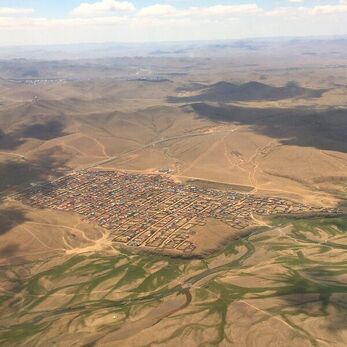
In this project we will be collected household survey data to track how rural out-migration and subsequent changes in rural demographics and labor are impacting traditional livestock management practices across the central Mongolian steppe. These data will be linked to spatio-temporal estimates of grassland condition derived from high resolution imagery from UAVs (drones).
New project (!) funded by NASA LCLUC program, in collaboration with Dr. Qiongyu Huang at the Smithsonian Conservation Biology Institute, Dr. Nicole Motzer at Montana State University and Dr. Tungalag Ulambayar in Mongolia.
In this project we will be collected household survey data to track how rural out-migration and subsequent changes in rural demographics and labor are impacting traditional livestock management practices across the central Mongolian steppe. These data will be linked to spatio-temporal estimates of grassland condition derived from high resolution imagery from UAVs (drones).
|
Classifying Timeseries Trajectories
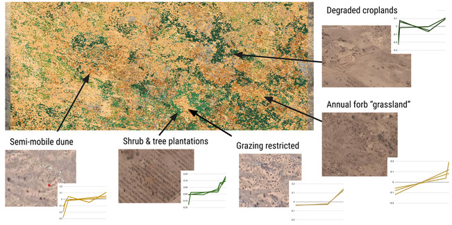
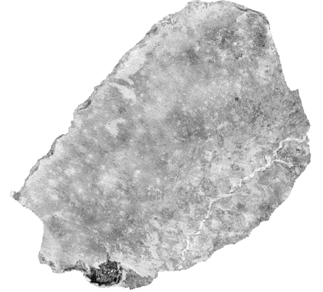
We're utilizing the full archive of Landsat data, available through Google Earth Engine, to characterize changes in vegetation in northern China over the past 40 years. We then utilize this information to create a new classification based on similarities in timeseries signatures, such as the timing and magnitude of changes. These unique archetypes can be linked to specific policy and management interventions. Grad student Mia Murray is developing this work to map land cover histories in the Xilingol grasslands of Inner Mongolia Establishing new baseline data on historic land cover in northern China Read more about this project in my tweet thread here! Most of the information we have about land cover change over time is limited temporally by the availability of satellite data, so most work only extends to the early 1980s. But what if we could go back further?? Grad student Brooke Iacone has georeferenced a set of declassified surveillance imagery from northern China in the late 1960s to give us our first understanding of the scale of grassland degradation during the Cultural Revolution. She is using this information to generate a land cover classification for 1970, |
METASTUDY
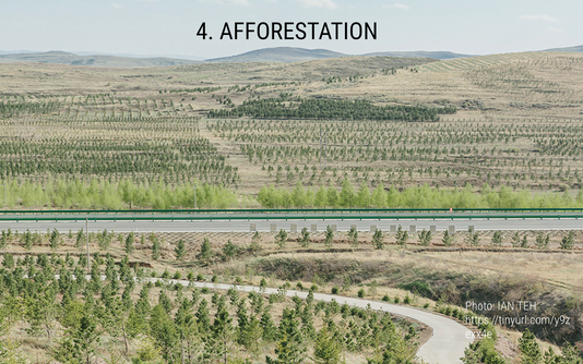 photo credit: IAN TEH
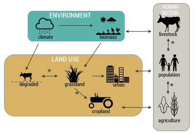
Ongoing work in the lab is surveying the empirical evidence to date on the impacts of massive afforestation efforts in northern China on biophysical conditions.
In parallel work, we are building a database of known plantations that we will use to train models to identify and map afforestation across the region at multiple time points, in order to estimate the scale of planting, as well as the ultimate fate of different planting schemes.
In parallel work, we are building a database of known plantations that we will use to train models to identify and map afforestation across the region at multiple time points, in order to estimate the scale of planting, as well as the ultimate fate of different planting schemes.